Airops Aeronautical Map is a next-generation platform built to enhance situational awareness in flight operations. With real-time tracking, live weather overlays, and intelligent alerts, Airops empowers airlines and dispatchers to make faster, safer, and more informed decisions—before, during, and after every flight.
Quick and Easy Access to Aviation’s Critical Components
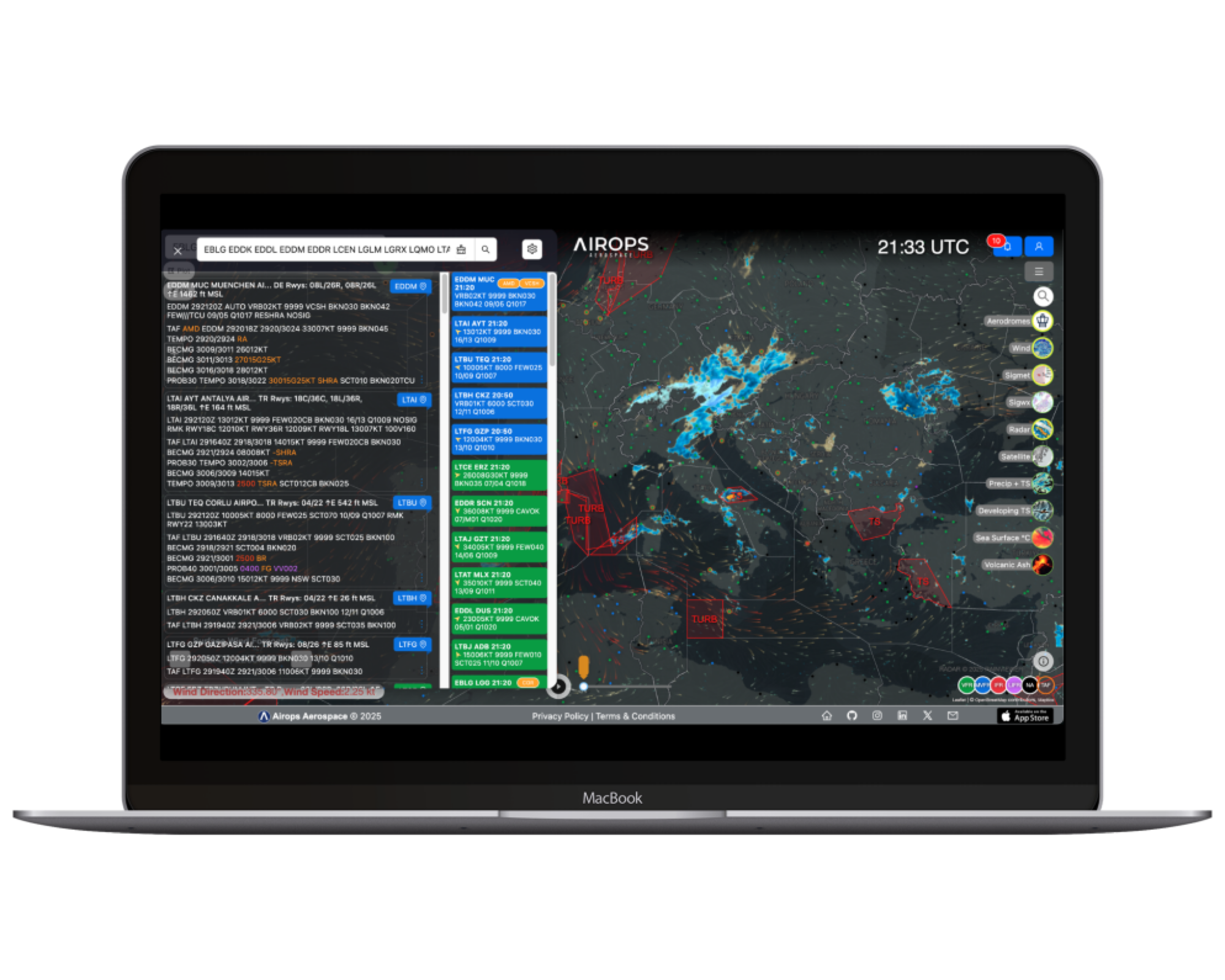
METAR and TAF reports are essential for global flight operations, serving as the cornerstone of flight safety. In airspace management and flight planning, having accurate information at the right time plays a critical role in ensuring safe and efficient operations.
Our platform offers unique features for pilots, air traffic controllers, and aviation professionals:
METAR & TAF Reports: Stay informed with real-time weather data to ensure top-level flight safety.
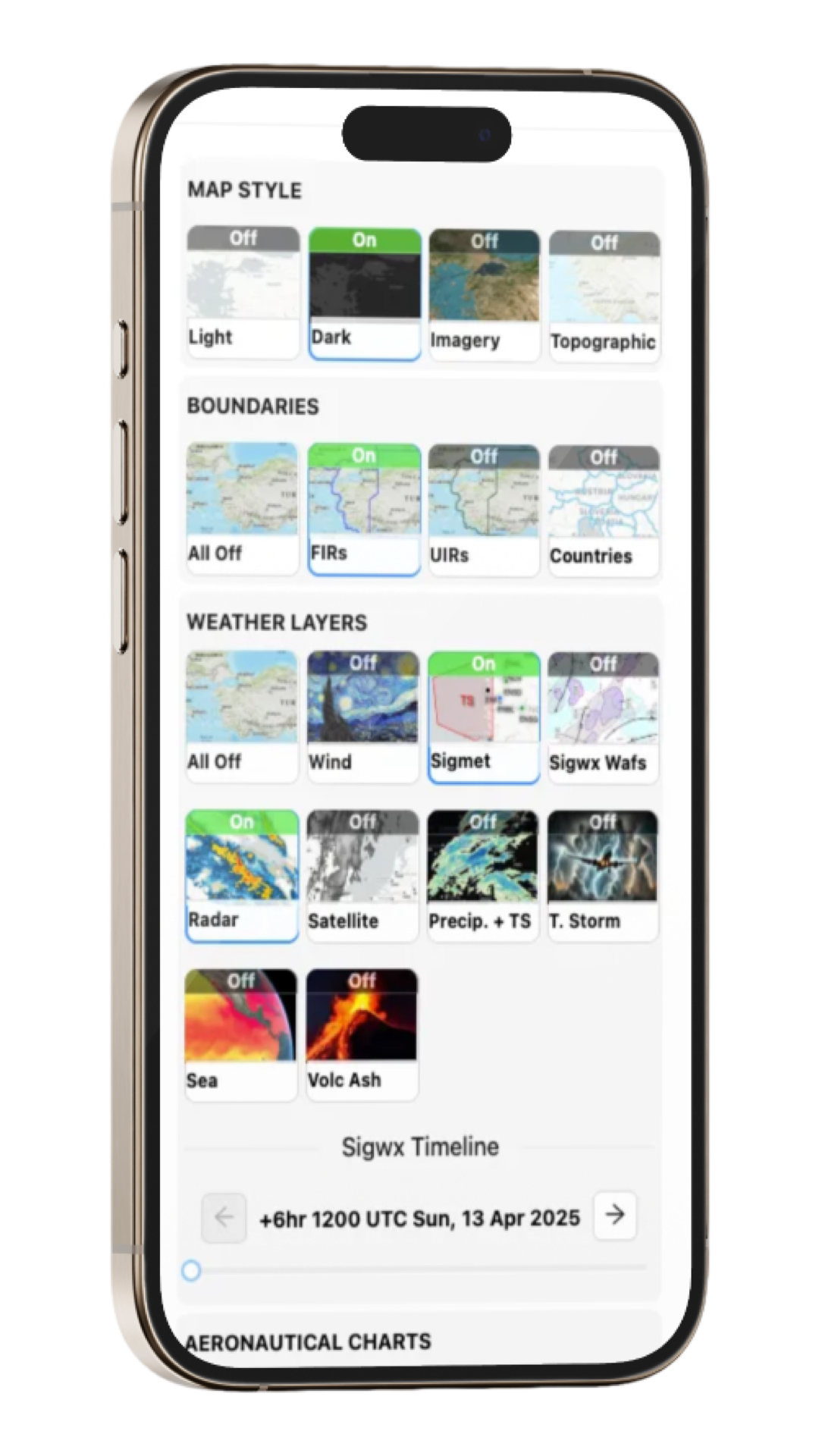
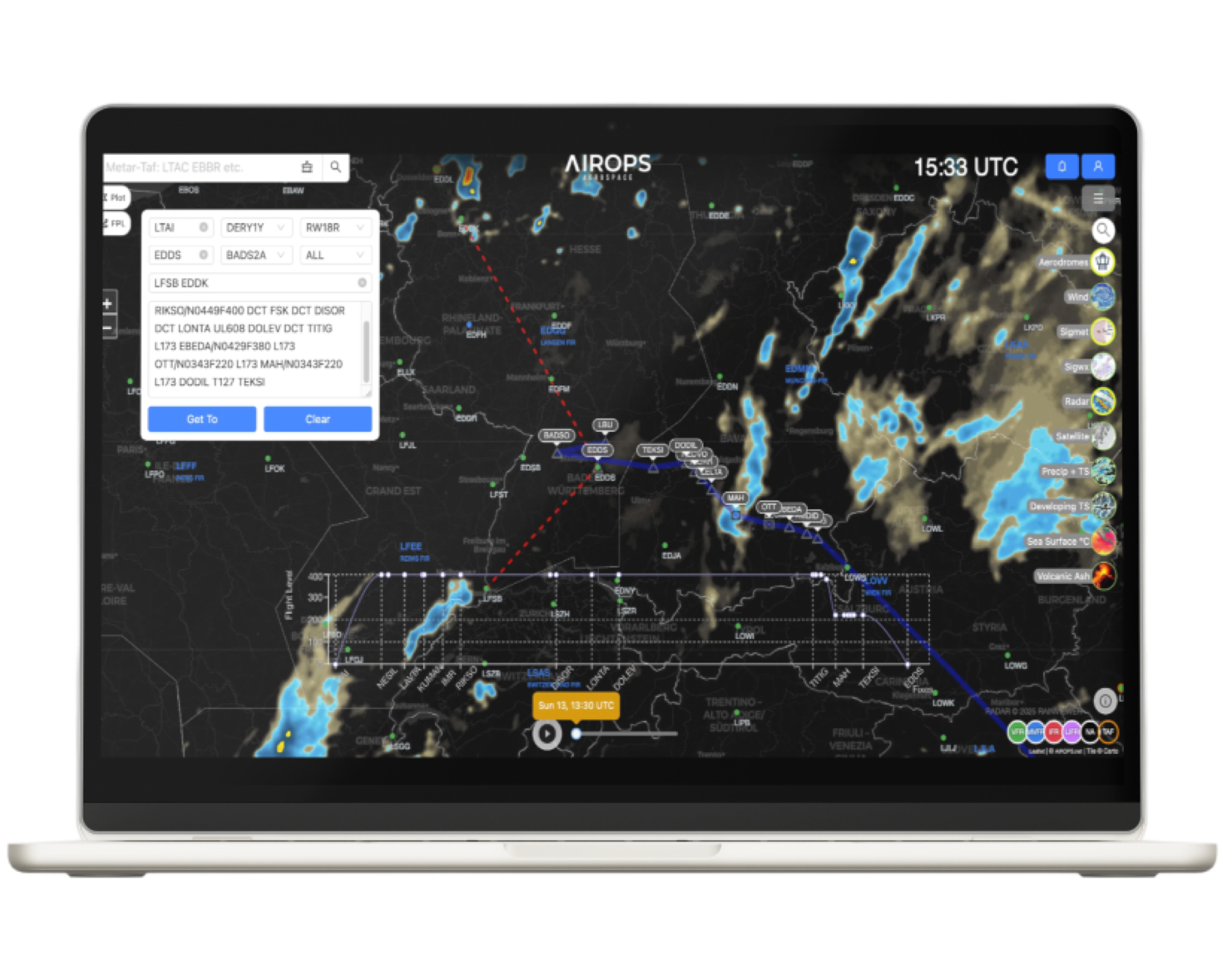
ATC Boundaries: Detailed information on air traffic control boundaries for seamless navigation.
Weather Layers: Instantly monitor atmospheric conditions with SIGMETs and weather radar layers to optimize your flight routes.
With comprehensive data and a user-friendly interface, this platform meets the complex demands of modern aviation.
Stay Ahead with Real-Time METAR & TAF Monitoring
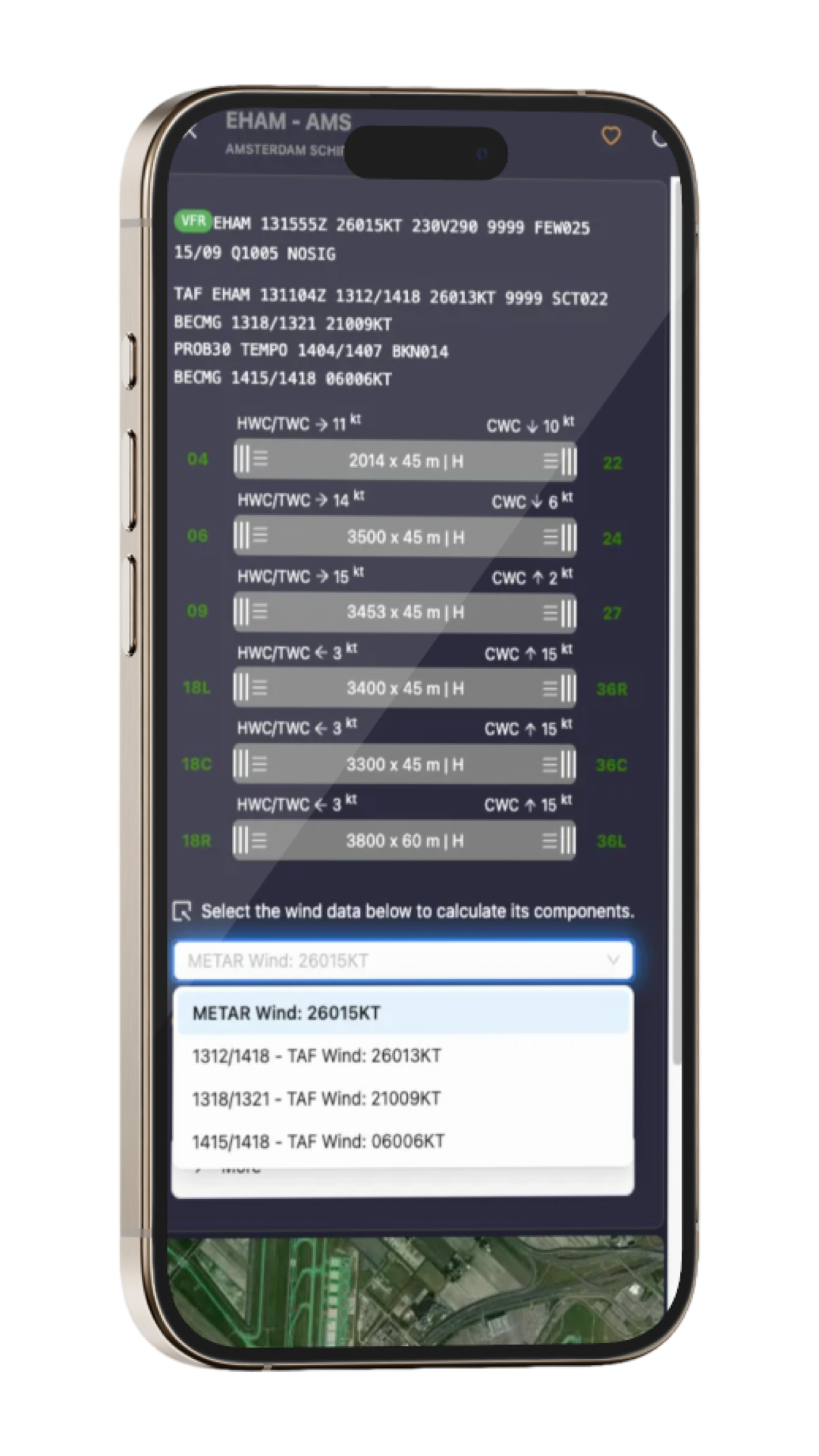
Our Metar TAF Monitoring Page empowers you to make informed decisions by providing real-time weather updates and alerts tailored to your operational needs. This comprehensive monitoring tool includes:
Popup and Sound Alerts: Customizable alerts based on user-defined visibility and ceiling thresholds at selected airports.
TAF Amendments and Corrections Alerts: Instant notifications for any updates to Terminal Aerodrome Forecasts (TAF).
Wind Component Calculations: Automatically calculates Cross Wind, Head Wind, and Tail Wind components.
Standardized Flight Category Colors: Visual clarity with color coding for flight categories (IFR, LIFR, MVFR, VFR).
Flight Category Sorting: Sort METAR reports by flight categories from worst to best (LIFR, IFR, MVFR, VFR).
Weather Phenomena Colors: Clear differentiation with standardized colors for weather phenomena (-RA, -TS, SN, +TSRA, +RA, etc.).
Auto Update & Check Intervals: Stay up-to-date with automatic updates and customizable check intervals.
Enroute Weather Monitoring: Monitor weather conditions along your planned route.
ICAO Code Search: Search airports by ICAO code, IATA code, or airport name.
With this advanced monitoring system, you can ensure your operations are supported by accurate and timely weather information.
A New Era in Flight Planning with Airops CopilotSelecting the optimal runway based on current wind conditions is one of the most critical decision points in flight operations. Even slight changes in wind speed and Read more…
🚀 Breaking the Boundaries of Real-Time Flight Tracking: Airops Aerospace x Spire Aviation In the world of aviation technology, every millisecond counts. Accurate, real-time data can make the difference between a smooth flight and a Read more…
Enhancing Flight Planning in Simulation: A Comprehensive Look at AIROPS Aeronautical Map Beta Flight planning has always been one of the most critical aspects of any successful operation—even in the world of flight simulation. A Read more…